Place Names of New Brunswick: Where is Home? New Brunswick Communities Past and Present
 Introduction |
  Alphabetical Listing |
  County Listing |
  Indexes |
  Definitions
 Skip Navigation Links
Located 3.71 km N of
Saint-Pierre-de-Kent, on the road to
Rexton:
Wellington Parish,
Kent County: PO
Ste. Anne 1879-1897: PO
Ste-Anne-de-Kent from 1897: in 1898 Sainte-Anne-de-Kent was a farming and lumbering community with 1 store, 1 post office, 1 church and a population of 200: included the settlement of
Côte-Sainte-Anne: PO
Côte-Sainte-Anne 1908-1956.
Latitude
:
46° 33'
Longitude
:
64° 46'
County
:
Kent
Parish
:
Wellington
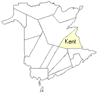
County location in province

 County map showing parishes
 Zoom in

Cadastral Maps
New Brunswick cadastral maps show the basic features of the province along with the boundaries, lot number, and grantee’s name for land granted by the province. These maps are cumulative, showing all grants regardless of date.
Zoom in

or
download
the full size version.
3690 x 2736 - 1.8 mb
|