Place Names of New Brunswick: Where is Home? New Brunswick Communities Past and Present
 Introduction |
  Alphabetical Listing |
  County Listing |
  Indexes |
  Definitions
 Skip Navigation Links
Located on Shediac Bay, 1.85 km S of
Pointe-du-Chêne:
Shediac Parish,
Westmorland County: William Francis Ganong identified the Mi'kmaq name for Shediac as Esedev'ik: during the 17th Century the French called the area
Chédiac ou
Chédiac: PO
Shediac from 1829: in 1866 Shediac was a farming community with 130 families: in 1871 Shediac had a population of about 500: in 1898 Shediac was a sub-port of entry and a station on the Intercolonial Railway and had 1 post office, 13 stores, 2 hotels, 1 boot factory, 2 steam sawmills, 1 flour mill, 1 tannery, 3 carriage factories, 5 churches and 1 convent, and a population of 2,000: Shediac was incorporated as a town in 1903.
Latitude
:
46° 13'
Longitude
:
64° 32'
County
:
Westmorland
Parish
:
Shediac
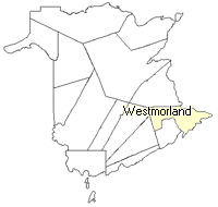
County location in province

 County map showing parishes
 Zoom in

Cadastral Maps
New Brunswick cadastral maps show the basic features of the province along with the boundaries, lot number, and grantee’s name for land granted by the province. These maps are cumulative, showing all grants regardless of date.
Zoom in

or
download
the full size version.
3722 x 2775 - 2.8 mb
|