Place Names of New Brunswick: Where is Home? New Brunswick Communities Past and Present
 Introduction |
  Alphabetical Listing |
  County Listing |
  Indexes |
  Definitions
 Skip Navigation Links
Located 3.17 km NW of
Shediac, on the road to
Cocagne:
Shediac Parish,
Westmorland County: PO 1859-1966 with S. Hannington as an early postmaster: in 1866 Smiths was a farming community with approximately 36 families, including the family of Thomas E. Smith: in 1871 it had a population of about 150: Smiths became part of
Shediac Cape.
Latitude
:
46° 14'
Longitude
:
64° 34'
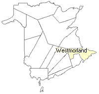
County
:
Westmorland
Parish
:
Shediac
County location in province

 County map showing parishes
 Zoom in

Cadastral Maps
New Brunswick cadastral maps show the basic features of the province along with the boundaries, lot number, and grantee’s name for land granted by the province. These maps are cumulative, showing all grants regardless of date.
Zoom in

or
download
the full size version.
3722 x 2775 - 2.8 mb
|