Place Names of New Brunswick: Where is Home? New Brunswick Communities Past and Present
 Introduction |
  Alphabetical Listing |
  County Listing |
  Indexes |
  Definitions
 Skip Navigation Links
Located on W side of the Petitcodiac River, 2.26 km SE of
Hillsborough, on the road to
Edgetts Landing:
Hillsborough Parish,
Albert County: included the settlement of Lower Hillsborough: PO 1853-1872: in 1866 Lower Hillsborough was a farming community with approximately 9 resident families: in 1871 Lower Hillsborough had a population of 50: also included the settlement of Centreville: PO
Centreville 1866-1875: in 1871 Centreville had a population of 200: PO
Surrey 1875-1970: in 1898 Surrey had 1 post office, 3 stores, 2 churches and a population of 150: Surrey was incorporated as a village in 1966.
Latitude
:
45° 55'
Longitude
:
64° 38'
County
:
Albert
Parish
:
Hillsborough
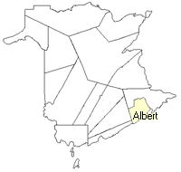
County location in province

 County map showing parishes
 Zoom in

Cadastral Maps
New Brunswick cadastral maps show the basic features of the province along with the boundaries, lot number, and grantee’s name for land granted by the province. These maps are cumulative, showing all grants regardless of date.
Zoom in

or
download
the full size version.
3760 x 2767 - 2.4 mb
|