Place Names of New Brunswick: Where is Home? New Brunswick Communities Past and Present
 Introduction |
  Alphabetical Listing |
  County Listing |
  Indexes |
  Definitions
 Skip Navigation Links
Located on W side of the St. John River, 5.48 km ESE of
Meductic and 2.26 km NW of
Middle Southampton:
Canterbury Parish,
York County: included the settlement of
Sullivan: PO
Temple 1885-1917: in 1904 Temple was a farming settlement with 1 post office, 1 store, 1 church and a population of 50.
Latitude
:
45° 59'
Longitude
:
67° 25'
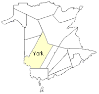
County
:
York
Parish
:
Canterbury
County location in province

 County map showing parishes
 Zoom in

Cadastral Maps
New Brunswick cadastral maps show the basic features of the province along with the boundaries, lot number, and grantee’s name for land granted by the province. These maps are cumulative, showing all grants regardless of date.
Zoom in

or
download
the full size version.
3676 x 2769 - 2.7 mb
|