Place Names of New Brunswick: Where is Home? New Brunswick Communities Past and Present
 Introduction |
  Alphabetical Listing |
  County Listing |
  Indexes |
  Definitions
 Skip Navigation Links
Located on the St. John River, at the mouth of the Bellisle Bay, 1.3 km W of
Lower Kars:
Kars Parish,
Kings County: Ganong identified the Maliseet name as
Peskayboc'ms: PO
Tenants Cove 1860-1916: in 1866 Tennants Cove was a farming community with 80 families, including 13 Jones families and 6 Urquhart families: in 1871 it had a population of about 200: in 1898 Tennants Cove had 1 post office and a population of 140: PO
Tennant Cove 1927-1931.
Latitude
:
45° 35'
Longitude
:
66° 0'
County
:
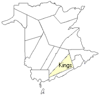
Kings
Parish
:
Kars
County location in province

 County map showing parishes
 Zoom in

Cadastral Maps
New Brunswick cadastral maps show the basic features of the province along with the boundaries, lot number, and grantee’s name for land granted by the province. These maps are cumulative, showing all grants regardless of date.
Zoom in

or
download
the full size version.
3680 x 2837 - 2.8 mb
|