Place Names of New Brunswick: Where is Home? New Brunswick Communities Past and Present
 Introduction |
  Alphabetical Listing |
  County Listing |
  Indexes |
  Definitions
 Skip Navigation Links
Located on the Restigouche River, 4.96 km W of
Dalhousie, on the road to
Dalhousie Junction:
Dalhousie Parish,
Restigouche County: PO
Point La Nin 1855-1862: PO
Point La Nim 1862-1949: in 1866 Point La Nim was a farming settlement with about 37 families including 5 Ferguson and 5 McNeish families: in 1871 it had a population of 150: in 1898 Point La Nim had 1 post office, 1 carriage factory and a population of 75.
Latitude
:
48° 4'
Longitude
:
66° 27'
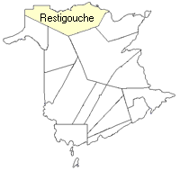
County
:
Restigouche
Parish
:
Dalhousie
County location in province

 County map showing parishes
 Zoom in

Cadastral Maps
New Brunswick cadastral maps show the basic features of the province along with the boundaries, lot number, and grantee’s name for land granted by the province. These maps are cumulative, showing all grants regardless of date.
Zoom in

or
download
the full size version.
2830 x 3647 - 2.8 mb
|