Place Names of New Brunswick: Where is Home? New Brunswick Communities Past and Present
 Introduction |
  Alphabetical Listing |
  County Listing |
  Indexes |
  Definitions
 Skip Navigation Links
Located on W side of the St. John River at the mouth of the Aroostook River, 3.92 km SSE of
Four Falls:
Andover Parish,
Victoria County: PO
Arestook 1852-1854: PO
Aroostook 1854-1879: PO
Aroostook Junction from 1879: in 1871 the community and surrounding district had a population of 400: in 1898 Aroostook was a port of entry, a station on the Presque Isle Branch of the Canadian Pacific Railway and a community with 1 post office, 1 store and a population of 80: included the settlements of Four Falls and
Aroostook Portage: Aroostook was incorporated as a village in 1966.
Latitude
:
46° 48'
Longitude
:
67° 43'
County
:
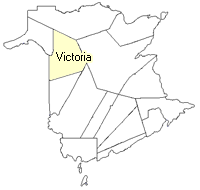
Victoria
Parish
:
Andover
County location in province

 County map showing parishes
 Zoom in

Cadastral Maps
New Brunswick cadastral maps show the basic features of the province along with the boundaries, lot number, and grantee’s name for land granted by the province. These maps are cumulative, showing all grants regardless of date.
Zoom in

or
download
the full size version.
3609 x 2757 - 2.4 mb
|