Place Names of New Brunswick: Where is Home? New Brunswick Communities Past and Present
 Introduction |
  Alphabetical Listing |
  County Listing |
  Indexes |
  Definitions
 Skip Navigation Links
Located on E side of the St. John River, 4.51 km NE of
Grafton, on the road to
Lower Brighton:
Northampton Parish,
Carleton County: established in 1873 when the Woodstock Branch was connected with the
Gibson line of the Canadian Pacific Railway: may have been called Junction Switch: PO
Newburgh 1866-1891: in 1866 Newburgh was a farming community with approximately 7 families: PO
Newburg Junction 1891-1957: in 1898 Newburg Junction was a station on the Canadian Pacific Railway and a settlement with 1 post office, 1 store, 1 church and a population of 150.
Latitude
:
46° 11'
Longitude
:
67° 32'
County
:
Carleton
Parish
:
Northampton
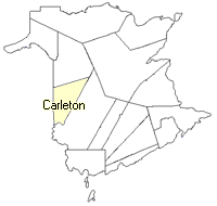
County location in province

 County map showing parishes
 Zoom in

Cadastral Maps
New Brunswick cadastral maps show the basic features of the province along with the boundaries, lot number, and grantee’s name for land granted by the province. These maps are cumulative, showing all grants regardless of date.
Zoom in

or
download
the full size version.
3694 x 2760 - 2.5 mb
|