Place Names of New Brunswick: Where is Home? New Brunswick Communities Past and Present
 Introduction |
  Alphabetical Listing |
  County Listing |
  Indexes |
  Definitions
 Skip Navigation Links
Located 1.85 km S of
Rothesay:
Rothesay Parish,
Kings County: first called Applebys Wharf on Kennebecasis River: included Riverside Beach: PO 1898-1900: in 1898 Riverside Beach was a station on the Intercolonial Railway and a farming community with a population of 110: PO
East Riverside 1911-1969:
Kingshurst was a settlement and a Canadian National Railway station: East Riverside-Kingshurst was incorporated as a village in 1966.
Latitude
:
45° 22'
Longitude
:
66° 0'
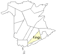
County
:
Kings
Parish
:
Rothesay
County location in province

 County map showing parishes
 Zoom in

Cadastral Maps
New Brunswick cadastral maps show the basic features of the province along with the boundaries, lot number, and grantee’s name for land granted by the province. These maps are cumulative, showing all grants regardless of date.
Zoom in

or
download
the full size version.
3782 x 2794 - 2.6 mb
|