Place Names of New Brunswick: Where is Home? New Brunswick Communities Past and Present
 Introduction |
  Alphabetical Listing |
  County Listing |
  Indexes |
  Definitions
 Skip Navigation Links
Located on N side of the Buctouche River, 2.25 km NE of
Upper Buctouche, on the road to
Maria-de-Kent:
Saint Mary Parish,
Kent County: PO
St. Mary's 1872-1901: in 1871 it had a population of 100: in 1898 St. Mary's was a farming and fishing community with 1 post office, 4 stores, 1 cheese factory, 1 church and a population of about 1,000: included the community of Mount Carmel: PO from 1901: in 1904 Mount Carmel was a farming settlement with 1 post office, 4 stores, 2 churches and a population of 250: PO
Kent Boom 1919-1955: PO
Ste-Marie-de-Kent from 1955.
Latitude
:
46° 25'
Longitude
:
64° 49'
County
:
Kent
Parish
:
Saint Mary
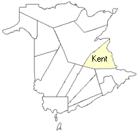
County location in province

 County map showing parishes
 Zoom in

Cadastral Maps
New Brunswick cadastral maps show the basic features of the province along with the boundaries, lot number, and grantee’s name for land granted by the province. These maps are cumulative, showing all grants regardless of date.
Zoom in

or
download
the full size version.
3616 x 2749 - 2.1 mb
|