Place Names of New Brunswick: Where is Home? New Brunswick Communities Past and Present
 Introduction |
  Alphabetical Listing |
  County Listing |
  Indexes |
  Definitions
 Skip Navigation Links
Located on the Magaguadavic River, 11.72 km SW of
Harvey, on the road to
Thomaston Corner:
Manners Sutton Parish,
York County: named for Lemuel Allan Wilmot (1809-1878), commissioner of lands in the
Harvey and
Cork areas, who assisted settlers in receiving land in 1838: Wilmot became part of York Mills.
Latitude
:
45° 40'
Longitude
:
67° 7'
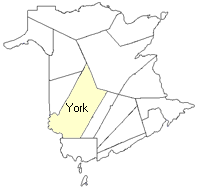
County
:
York
Parish
:
Manners Sutton
County location in province

 County map showing parishes
 Zoom in

Cadastral Maps
New Brunswick cadastral maps show the basic features of the province along with the boundaries, lot number, and grantee’s name for land granted by the province. These maps are cumulative, showing all grants regardless of date.
Zoom in

or
download
the full size version.
3733 x 2750 - 2.3 mb
|